WalnutHills.HistoryForge.net is our dedicated site for entering information about Walnut Hills. Click on The Forge in the top menu bar to see what we’ve loaded so far. The best place to start is the The Forge: Click on TheForge in the menu at the top right.
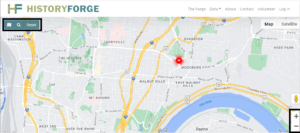
You’ll see a Google map of our neighborhood. Use the + sign at the bottom right to zoom in. The buttons at the upper left let you see the maps we’ve loaded.

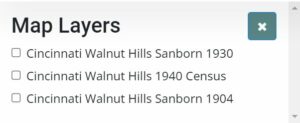
Click on the 1930 map to see Walnut Hills before I71 and MLK were put in.
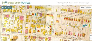
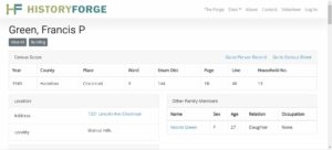
Each of the red dots represents a building. Most of these were entered through the 1940 Census. For example, by zooming in you should be able to find 1321 Lincoln Ave. Clicking on the red dot shows you that the owner was Francis Green. (We know him as the beloved former pastor of First Baptist Church of Walnut Hills.)
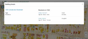
Clicking on his name in the Building Details will take you to the information about Pastor Green in the 1940 census:
If you get stuck or want to learn more about this work, please email walnuthillsstories@gmail.com or learn more about how to help.