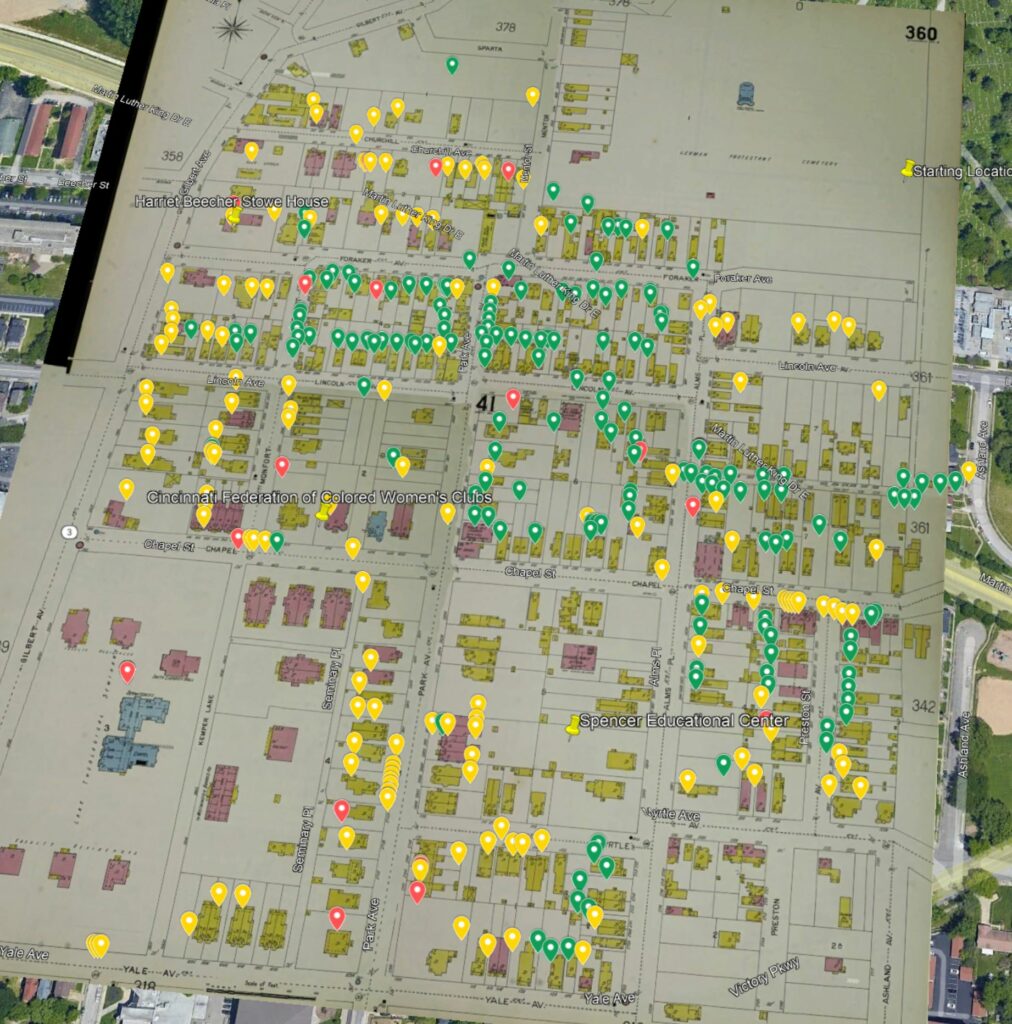
Using both Google Maps and Google Earth, we have been able to visually display the census data from 1900.
Google Maps shows each dwelling, color coded by race. Green pins indicate that the people who lived in that dwelling were Black; yellow pins indicate that the people were white; and red pins indicate that people of both races lived in the dwelling. You can click on a pin to see more information about the dwelling, including street address, number of people and home ownership.
Google Earth maps are not so interactive, but we have overlaid the stitched together Sanborn maps from 1904 onto Google Earth’s current map. We have also put the pins for each dwelling onto the 1904 overlay.
![]()
See more information about our research into the 1900 census.